Northeast Iceland forms a thinly populated, open expanse between Akureyri and the East Fjords. Tourists, along with most of Iceland’s wildfowl population, flock to Mývatn, an attractive lake just over an hour’s drive from Akureyri, whose surrounds are thick with hot springs and volcanic formations – many of them still visibly active – as well as a sublime geothermal spa that is the northeast’s answer to the Blue Lagoon. North of here, the pleasant town of Húsavík offers summer whale-watching excursions, and is just a short jaunt from Jökulsárgljúfur, where one of the region’s glacial rivers thunders through a series of gorges and waterfalls – a superb place to spend a few days hiking or camping.
The eastern half of the region has far less obvious attractions; indeed, the only real access to this mix of mountains, lava desert and boggy lowlands is along the coastal road between Húsavík and Vopnafjörður. However, it’s a great area for unhurried travel, bringing you close to some wild countryside, breezy coastal walks, and small, isolated communities – plus the chance to reach the mainland’s northernmost tip, which lies fractionally outside the Arctic Circle.
Away from Mývatn and Húsavík, services are thinly spread, though most settlements have a bank, a supermarket and somewhere to stay; elsewhere, there are farmstays, a few hostels, and limitless camping opportunities. The northeast’s weather is much drier and often sunnier than southern Iceland’s – and this far north it barely gets dark for three months of the year – though winters are bitterly cold, with heavy snowfalls throughout.
Tailor-made travel itineraries for Iceland, created by local experts
8 days / from2092 USD
Iceland: A Game of Thrones Road Trip
This themed road trip will take you around Iceland, home to many filming locations of the hit TV series, Game of Thrones. Travel around the country's coastline, past the many dramatic glaciers and cliffs, relax in geothermal spas, and spot whales in the rough seas. Warning: Spoiler alert!
view tour ⤍8 days / from2052 USD
Iceland's Wild West
Welcome to the road trip of a lifetime, which will bring you to some of western Iceland’s wildest and most remote spots. On this adventure, you will pay unforgettable visits to Hraunfossar Waterfalls, as well as the Barnafoss and Deildartunguhver hot springs, and much more!
view tour ⤍6 days / from1680 USD
Iceland's Highlights from East to West
Take a flight to the East where you get to enjoy the enchanting Eastfjords before you drive south. If you are looking to focus on a few regions with a mix of the most popular sights and something off the beaten path; and to avoid backtracking with a one-way domestic flight, this is the perfect trip.
view tour ⤍7 days / from1650 USD
Discover North Iceland and Snaefellses
Discover the best of North Iceland and Snaefellsnes! The area around the volcanic Lake Myvatn is surrounded by impressive geological sights, stunning waterfalls and mighty canyons! The Snaefellsnes peninsula is known as “miniature Iceland” for the diversity of landscape it offers.
view tour ⤍5 days / from1300 USD
Best of the West
Take the road less travelled around the Westfjords and Snaefellsnes peninsulas. Visit places unspoiled by humans and see the wonders and creativity of nature at their very best! The wild Westfjords feature a stunning landscape of towering mountains, deep blue fjords, and thundering waterfalls.
view tour ⤍8 days / from1880 USD
East to West with the Westmand Islands
Drive around the Lake Lagarfljot and visit Hengifoss waterfall and the Hallormsstadur forest. Continue to the South Coast with its beautiful waterfalls, glacier lagoons and black sand beaches. Take a detour to spend a day in the stunning Westman Islands and end your trip with the Golden Circle.
view tour ⤍13 days / from2200 USD
All of Iceland in 13 days
In just under 2 weeks, explore the highlights Iceland has to offer. From the popular Golden Circle, follow the Ring Road and explore waterfalls and lagoons on your way around the island. This itinerary leads you all the way to the North and the Westfjords of Iceland.
view tour ⤍12 days / from2100 USD
Incredible Iceland in 12 days
This driving trip trip will take you to some of Iceland’s most incredible sights and natural wonders. Drive through glacial valleys and across towering mountains as you gaze over stark landscapes of shining silver steaks and marble lava fields patched with emerald green moss...
view tour ⤍9 days / from1800 USD
West & Arctic Coast Way Highlights
The area around the volcanic Lake Myvatn is surrounded by impressive geological sights, stunning waterfalls and mighty canyons. Visit the 'capital of the North' Akureyri before continuing to the Snaefellsnes peninsula, known as “miniature Iceland” for the diversity of landscape it offers.
view tour ⤍6 days / from1600 USD
Exploring the South Coast and Snaefellsnes
Glaciers, volcanoes, black sand beaches, lagoons - Iceland offers stunning landscapes to explore. This itinerary allows you to discover the south in your own rental car. Drive the famous Golden Circle and discover waterfalls along the way.
view tour ⤍10 days / from1900 USD
Arctic Coast Way Fly & Drive
North Iceland is one of Iceland's most fascinating regions with plenty of famous sights and lesser-known sights - impressive waterfalls, geothermal activity, lava formations and canyons. A visit to Akureyri as well as charming fishing villages along the coastline are included in the itinerary.
view tour ⤍10 days / from2000 USD
Iceland: the Ring Road in 10 days
Spend 10 days driving along Iceland's scenic Ring Road, which stretches around the outside of the country. Soak in a thermal tub or pool beside gushing geysers or waterfalls, and relish the prospect of whale-watching, bird-watching, and glacier hiking in magical surroundings.
view tour ⤍7 days / from1700 USD
Wild, wild West Drive
The wild Westfjords feature a stunning landscape of towering mountains, deep blue fjords, thundering waterfalls, sea cliffs teeming with birds and rejuvenating hot springs! Snaefellsnes is known as “miniature Iceland” for the diversity of landscape it offers.
view tour ⤍7 days / from1700 USD
A week's trip to the South Coast and Snaefellsnes
With just a week's time, you'll be able to discover the popular Golden Circle, Skogafos and Seljalandsfoss, as well as Skaftafell National Park. This self-drive trip focuses on the south coast only, limiting your driving distances each day and as such allowing you more time to explore.
view tour ⤍6 days / from1600 USD
Classic Highlights with the Westman Islands
This Classic Highlights trip to Iceland's most visited sights with a day off the beaten path in the gorgeous Westman Islands. This trip is perfect for those who want to visit the most popular sights of Iceland, and have an extra day to do something different without adding a lot of extra driving.
view tour ⤍6 days / from1680 USD
Westfjords Circle and Strandir
The wild Westfjords feature a stunning landscape of towering mountains, deep blue fjords, thundering waterfalls, sea cliffs teeming with birds and rejuvenating hot springs! You also take a detour to where the road ends in remote Strandir to drive along the coastline.
view tour ⤍5 days / from1320 USD
Classic Highlights - Golden Circle & South Coast
Our most popular short trip to Iceland's most visited sights! The Golden Circle is Iceland's most popular tourist route with the rift valley at the Thingvellir National Park, Geysir geothermal area and the Gullfoss waterfall. The South Coast is well known for its waterfalls and the Glacier Lagoon.
view tour ⤍7 days / from1700 USD
Ring Road Express with the Golden Circle
Iceland's Ring Road is the most popular tourist route around the Iceland. The landscape is everything you have dreamed of - breathtaking waterfalls, volcanic landscape, black sand beaches, glaciers, fjords and charming fishing villages.
view tour ⤍6 days / from1600 USD
Explore North Iceland and Snaefellsnes
Discover the best of North Iceland and Snaefellsnes! The area around the volcanic Lake Myvatn is surrounded by impressive geological sights, stunning waterfalls and mighty canyons! The Snaefellsnes peninsula is known as “miniature Iceland” for the diversity of landscape it offers.
view tour ⤍6 days / from1250 USD
Western Iceland: Cliffs, Coast and Waterfalls
Welcome to the road trip of a lifetime, which will bring you to some of Iceland’s remotest spots, such the dramatic Latrabjarg Cliffs and the Hraunfossar and Barnafoss Waterfalls. Drive through glacial valleys and soak up breathtaking sunsets. Laze afternoons away soaking in natural hot springs!
view tour ⤍10 days / from1900 USD
Iceland: West and North combined
Take the road less traveled and explore the North and the Westfjords of Iceland in your own rental car. Glaciers, lava fields, beaches, waterfalls and much more await those adventurous enough to explore Iceland further.
view tour ⤍8 days / from1750 USD
Longer North Iceland and Snaefellsnes
Have a bit more time to explore Northern Iceland? Stunning waterfalls, mighty canyons, a diverse scenery and much more is waiting for you. Take your rental car and go at your own pace, discovering Northern Iceland in a bit over one week.
view tour ⤍7 days / from1800 USD
From East to West with the Westman Islands
Drive around the Lake Lagarfljot and visit Hengifoss waterfall and the Hallormsstadur forest. Continue to the South Coast with its beautiful waterfalls, glacier lagoons and black sand beaches. Take a detour to spend a day in the stunning Westman Islands and end your trip with the Golden Circle.
view tour ⤍8 days / from1750 USD
Wild West Drive and Strandir
This holiday is perfect for travellers who want to go off the beaten path and explore the stunning landscape of the Westfjords & Snaefellsnes including the remote Strandir regions. With your rented SUV, you can set your own schedule to explore the scenery.
view tour ⤍8 days / from1750 USD
Classic Ring Road with Snaefellsnes
There's a good reason the Ring Road is Iceland's most popular route: famous glaciers and volcanoes, stunning waterfalls, and amazing lagoons await. The Snaefellsnes peninsula makes the perfect add-on to your tour, granting you a compact overview of Iceland's scenery.
view tour ⤍8 days / from1750 USD
Extended Wild, Wild West
Awaken the adventurous part of your soul and visit the Westfjords and parts of the Snaefellsnes peninsula that are yet to be discovered by most Iceland visitors. Here's where you'll have nature to yourself, from lava fields and craters to red sand beaches.
view tour ⤍5 days / from1300 USD
North Iceland Fly and Drive
Take an adventure to North Iceland, one of Iceland's most fascinating regions! This holiday is perfect for those pressed on time, in just five days you get to explore the highlights of North Iceland in your own rental car, so going at your own pace.
view tour ⤍8 days / from1800 USD
Longer South Coast and Snaefellsnes
Discover the Golden Circle on a slightly longer tour: from waterfalls to black sand beaches, driving the popular Golden Circle all down to Snaefellsnes, the peninsula known as “miniature Iceland”, This itinerary allows you to go at your own pace in your own rental car.
view tour ⤍6 days / from1715 USD
Iceland: Landscapes and Lagoons
This unforgettable driving trip will take you to some of Iceland’s most iconic natural wonders. Whilst soaking luxuriantly in geothermal pools, you will relish the thought of driving through glacial valleys and across towering mountains, walking along black sand beaches.
view tour ⤍5 days / from1400 USD
Circling the Westfjords
Take the road less travelled around the Westfjords. Visit places unspoiled by humans and see the wonders and creativity of nature at their very best! Suited for those on a tight schedule, this 5 day itinerary allows for a compact yet activity-packed trip.
view tour ⤍8 days / from1750 USD
Iceland: the Ring Road in 8 days
Spend eight days driving along Iceland's iconic Ring Road route, which runs around the whole of the country. Pass through spectacular scenery every day, and stopping off to stay in Vik, Akureyri and Reykjavik, whilst exploring the Golden Circle, the Blue Lagoon, Lake Myvatn, and much more!
view tour ⤍5 days / from1400 USD
North Iceland circle
Take an adventure to North Iceland, one of Iceland's most fascinating regions! A rich wildlife and landscape makes this part of Iceland a visitor magnet all throughout the year. This holiday includes your domestic flight to Akureyri and a rental car to explore the region in depth.
view tour ⤍15 days / from2400 USD
All of Iceland in 15 days
The extension to our popular all of Iceland route: visit the spectacular Dettifoss waterfall on the diamond circle route, as well as one of the most remote regions in Iceland: Strandir. This itinerary is best for those looking to explore Iceland at a leisurely pace.
view tour ⤍11 days / from3549 USD
The Magic of Eastern Iceland
Be enchanted by eastern Iceland as you drive through glacial valleys and across towering mountains, looking over treeless landscapes of shining silver streaks and marble lava fields patched with emerald green moss. Enjoy a whale-watching trip at Húsavík and soak in geothermal pools.
view tour ⤍9 days / from1900 USD
Classic Iceland in 9 days
This tour includes all of Iceland's highlights: the breathtaking waterfalls on the Ring Road, the popular golden Circle as well as the Snæfellsnes peninsula with its dramatic landscapes. Get ready for a fast-paced self-drive adventure and discover Iceland.
view tour ⤍16 days / from2500 USD
Total Immersion: Your 16-day Road Trip
Ready to explore the nooks and crannies of Iceland? This 16-day itinerary allows you to discover the tourist highlights as well as the off-the-beaten-track destinations. From waterfalls over glaciers to volcanoes - tour the island in your own rental car.
view tour ⤍Mývatn
Around 100km east of Akureyri on the Ringroad, Mývatn’s placid, shallow spread of water belies its status as one of the country’s most touristed locations. Admittedly, Mývatn has had its detractors ever since the Middle Ages – when the lake and its steaming surrounds were fearfully dismissed as a pool of the devil’s piss – though the only annoyance nowadays are summertime swarms of tiny black flies (Mývatn means “Midge Lake”). These provide an abundant food source for both fish and the hundreds of thousands of wildfowl which descend on the lake each year to raise their young: all of Iceland’s duck species breed either here or on the Laxá, Mývatn’s fast-flowing, salmon-rich outlet, and one – Barrow’s goldeneye – nests nowhere else in Europe.
Most people base themselves at Reykjahlíð, a small service centre on the northern side of the lake, though a few alternatives are dotted elsewhere around the shore – especially at southerly Skútustaðir. A good road circuits Mývatn, with tracks and footpaths elsewhere, and two busy days are enough to take in the main sights. Mývatn looks its best in summer, but can get very crowded then: it’s a toss-up to decide whether there are more tourists, insects or ducks. As for the flies: a few bite, but most just buzz irritatingly around your face – keep them off by buying a hat with attached netting. Alternatively, come in winter for watching the Northern Lights; or hit a few good days in late spring and, while you’ll miss out on the birdlife, there are no flies and you’ll have the place to yourself – though facilities are limited out of season.
The lakeshore
The road curves clockwise around the lakeshore from Reykjahlíð, via the hamlets of Vogar and Skútustaðir to where the Laxá drains westwards; from here, the Ringroad crosses the river and heads up the west shore and back to town. This circuit is about 35km long, with several places to make detours, principally at Grótagjá hot springs; the rough lavafield at Dimmuborgir and Hverfell cone, both east of the lake; and Vindbelgjarfjall, a peak on Mývatn’s northwestern side. Aside from the highly visible wildfowl, keep your eyes peeled for ptarmigan, Arctic foxes and maybe even rare gyrfalcons. Note that erosion is a serious problem at many popular sites and that you should stick to marked paths where you find them.
No tours circuit the lake, so to see it all you really need your own vehicle – bicycles can be rented in Reykjahlíð. You can of course walk; there’s a well-marked, 8km trail linking Reykjahlíð with Grótagjá, Hverfell and Dimmuborgir. To explore away from here, carry Landmælingar Íslands Mývatn 1:50,000 map – the Reykjahlíð visitor centre might have these, otherwise Akureyri’s bookshops are the nearest source.
Mývatn’s ducks
In summer, plentiful food and nesting space make Mývatn the best place in northern Europe to see wild ducks – it’s possible to clock up eighteen species during your stay. Their favourite nesting area is in spongy heathland on the northwest side of the lake, though more accessible places to spy on them include Mývatn’s southeastern corner (especially good for Barrow’s goldeneye); the Laxá outflow on the western side of the lake (for harlequin ducks); and even the shore at Reykjahlíð (anything). Female ducks tend to be drably coloured, to blend in with vegetation while incubating their eggs, and unless otherwise stated, the following descriptions are of breeding drakes.
Several types of duck at Mývatn have a black head with a black and white body. The most celebrated is Barrow’s goldeneye, resident year-round and easily identified by a characteristic white comma-shaped patch between the manic golden eye and bill. Keep an eye open too for their black-and-white striped chicks. Barrow’s goldeneye are most likely to be confused with either the similar-looking tufted duck or scaup, though neither shares its “comma” – tufted ducks also have a droopy back-swept crest, while the scaup has a grey, not white, back.
Mývatn’s other speciality is the harlequin duck, here from May until July, which sports unmistakable chestnut, white and blue plumage. As indicated by the Icelandic name – straumönd, stream duck – harlequins are most often seen bobbing in and out of rough water on the Laxá. Other marine ducks spending their summers at Mývatn include the scoter, a uniquely all-black diving duck, which in Iceland breeds only at Mývatn, and the long-tailed or old squaw, another strikingly patterned bird with a summer plumage including a black neck and crown and very long, pointed tail (the similar pintail has a white throat, though so does the long-tail in winter).
Otherwise, you’ll be fairly familiar with most of Mývatn’s ducks, which are primarily freshwater species. Some of the more plentiful include the mallard; the red-headed pochard; the long-beaked merganser and goosander, and the wide-beaked shoveler; wigeon, with their coppery heads and vertical blond streak between the eyes; the uniformly nondescript gadwall; and teals, which sport a glossy red head and green eyepatch.
Northeast of Mývatn
While Mývatn’s immediate surrounds appear fairly stable, the plateau rising just outside Reykjahlíð at Bjarnarflag and extending northeast is anything but serene, the barren, pock-marked landscape pouring out lively quantities of steam and – when the mood takes it – lava. This being Iceland you can see not only how destructive such events have been, but also how their energy has been harnessed. Alongside power stations and even an underground “bakery”, there are the Jarðböðin nature baths, building on the centuries-old tradition of using the area’s plentiful geothermal water for bathing. Beyond here, still on the Ringroad, the bubbling mud pools at Hverir are definitely worth a stop en route to the Krafla volcano, reached by a detour north along a sealed track. The mountain and the neighbouring plains at Leirhnjúkur, still dangerously hot after a particularly violent session during the 1980s, are Mývatn’s most geologically active region.
Jarðböðin Nature Baths
Only 4km from Reykjahlíð, Bjarnarflag is a thermal zone on the lower slopes of Dalfjall, a long, faulted ridge pushed up by subterranean pressures that runs northeast to Krafla itself. Bjarnarflag has a small geothermal power station (Iceland’s first, built in 1969), whose outflow has been harnessed to create the Jarðböðin Nature Baths, the local version of Reykjavík’s Blue Lagoon. It’s an exceptional setting – fractured orange hills rise behind and the poolside overlooks Mývatn itself – where you can loll to your heart’s content in milky-blue waters heated to 38–40˚C. Just remove any copper or silver jewellery before entering the water, since the high sulphur content of the water can cause discoloration. In addition to the pool, there’s a café, hot pot and a couple of steam saunas.
Krafla and Viti
Up in the hills north of Hverir, the area around the Krafla volcano has been intermittently erupting for the last three thousand years and shows no signs of cooling down yet. The 7km access road runs north off the Ringroad opposite Hverir, passing right under piping from Leirbotn geothermal power station. Krafla itself (818m) was last active in the 1720s during a period known as the Mývatn Fires, which began when the west side of Krafla exploded in 1724, forming a new crater named Viti (Hell). The road ends at a car park in front of Viti, now a deep, aquamarine crater lake on Krafla’s steep brown gravel slopes; a slippery track runs around the rim through atmospheric low cloud and plenty of real steam hissing out of bulging vents.
Leirhnjúkur
West of Krafla is Leirhnjúkur, a black, compellingly grotesque lavafield whose eighteenth-century eruptions nearly destroyed Reykjahlíð’s church. A similar event between 1977 and 1984 reopened the fissures in what came to be called the Krafla Fires, and this mass of still-steaming lava rubble is testament to the lasting power of molten rock: thirty years on, and the ground here remains, in places, too hot to touch. Pegged tracks from the parking area mark out relatively safe trails around the field, crossing older, vegetated lava before climbing onto the darker, rougher new material, splotches of red or purple marking iron and potash deposits, white or yellow patches indicating live steam vents to be avoided – not least for their intensely unpleasant smell. From the high points you can look north towards where the main area of activity was during the 1980s at Gjástykki, a black, steaming swathe between light green hills. As usual, apply common sense to any explorations.
Northwest of Mývatn
There are a couple of historic sites worth a brief stop northwest of Mývatn, on your way between the lake and either Akureyri or Húsavík: Goðafoss is an impressive waterfall right beside the Ringroad, while the turf-roofed farm at Grenjaðarstaður dates back to the Middle Ages.
Fosshól and Goðafoss
Around halfway between Mývatn and Akureyri along the Ringroad, tiny Fosshól comprises little more than a couple of houses and a fuel pump, marking where the Sprengisandur route emerges from Iceland’s interior, and warrants a stop to see where the ice-blue Skjálfandafljöt river tears through horseshoe-shaped basalt canyons in a pair of powerful cataracts. The largest of these, Goðafoss (waterfall of the gods), is where Þorgeir Ljósvetningagoði – the lawspeaker who decided that Christianity should be Iceland’s official religion at the historic Alþing in 1000 – destroyed his pagan statues by pushing them over the falls.
Grenjaðarstaður
Sitting exposed to the prevailing icy winds in a broad valley, Grenjaðarstaður is a nineteenth-century church and block of well-insulated turf-roofed farmhouses, now a museum (June–Aug). The estate was founded in medieval times (a contemporary altar cloth from the original church is now in the Paris Louvre) when it counted as one of the best holdings in all Iceland, and now comprises the largest collection of period buildings in the country. Most of the rooms are kept as they were when last lived in, full of household items and farming implements from days gone by, though one building has been taken back to its original state, with beaten earth floors and central stone fireplace and kitchen.
Tjörnes
North of Húsavík along Route 85, Tjörnes is a rather broad, stubby peninsula with brilliant sea views. A few kilometres from town in this direction there’s a roadside monument to the locally born patriotic poet Einar Benediktsson, one of the key figures of Iceland’s early twentieth-century nationalist movement. Past here, now
5km from Húsavík, the headland drops to a low beach, reached along vehicle tracks from the road, where you should find the usual melange of seabirds, including purple sandpipers, puffins, black guillemots and gannets; in spring, look out for marine ducks and divers (loons) heading to Mývatn. Walking along the beach, it’s not unusual to find yourself being followed offshore by seals.
Tjörneshöfn
Around 10km from Húsavík, beside some sheer cliffs, a track off the main road descends to Tjörneshöfn, a tiny boatshed and harbour looking straight out to puffin-infested Lundey. A shingle beach stretches in both directions below the cliffs, though a small river to the north may stop you heading that way; south there’s plenty of seaweed and Pleistocene-period fossilized shells in the headland’s layered, vertical faces.
Öxarfjörður
Back on Route 85, Tjörnes’ northern tip is marked by the Voladalstorfa lighthouse, past which there’s a roadside viewpoint with vistas out over the staggeringly blue waters of Öxarfjörður to Kópasker. Puffins and fulmars nest on the grass-topped cliffs right beside the viewpoint; on a clear day it’s possible to pick out a very remote Grímsey to the northwest, and Mánárayjar, a couple of closer volcanic islets that haven’t experienced any stirrings for over a century.
Jökulsárgljúfur National Park
Cutting into the northeast’s rocky inland plains, Jökulsárgljúfur National Park – an isolated fragment of the enormous Vatnajökull National Park – encloses a 35km stretch of the Jökulsá á Fjöllum, Iceland’s second-longest river. Originating almost 200km south at Vatnajökull, for much of its journey through the park the river flows through the mighty Jökulsárgljúfur, a canyon which is 120m deep and 500m wide in places, forming several exceptional waterfalls and an endless array of rock formations. There are two key sights: the horseshoe-shaped Ásbyrgi canyon in the north of the park, an hour’s drive from Húsavík; and Dettifoss, Europe’s most powerful waterfall, at the park’s southern boundary near Mývatn. In between, the silt-laden river cuts its way between stark grey gorge walls, all set against an unusually fertile backdrop: over half of the country’s native plant species are found here, and in summer the heathland above the gorge is lush and splashed pink and white with flowers.
Ásbyrgi and Dettifoss are connected by hiking trails and two roads either side of the gorge: westerly Route 862, which is rough gravel except for the final 24km stretch between Dettifoss and the Ringroad (there’s long been talk of surfacing the entire thing); and easterly Route 864, which is gravel the whole way. Note that both roads are closed through winter.
Ásbyrgi
The northern end of Jökulsárgljúfur National Park is marked by an N1 roadhouse in the middle of nowhere on Route 85, behind which you’ll find a golf course, the National Parks Visitor Centre and the park’s main campsite. Here the gorge is very broad and waterless, the river having shifted course long ago leaving a flat grassland between low walls. You can get a good view of this from Eyjar, a long, flat-topped island of rock near the campsite which can be scaled easily enough from its northern end.
Better, though, is Ásbyrgi, where the road dead-ends 5km south at a pond fringed in birch and pine woods, beyond which rises a vertical, 90m-high amphitheatre of dark rock patched in orange lichens, home to a colony of gurgling fulmars. Legend has it that this is the hoofprint of the Norse god Óðinn’s eight-legged steed Sleipnir, though geologists believe that the formation was carved by a series of titanic jökulhlaups, volcanically induced flash-floods that exploded out from underneath Vatnajökull. Just avoid it in the late afternoon, when the sun catches the cliffs: it looks fantastic, but half of Iceland descends to watch. The view from the top is spectacular, too, though to get up here you need to follow the first few kilometres of the Dettifoss trail.
The Ásbyrgi to Dettifoss hike
It takes around two days to hike the straightforward 35km route from Ásbyrgi down the west side of the gorge to Dettifoss, with an overnight stop along the way at Vesturdalur (alternatively, the day-return hike to Vesturdalur makes a good trip in itself). Take a tent, cooking gear and all supplies with you; in summer, SBA runs a daily Akureyri–Húsavík–Ásbyrgi–Vesturdalur–Dettifoss bus, with a connecting Dettifoss–Mývatn service, so you could arrange a drop-off or pick-up along the way.
The trailhead is signposted behind Ásbyrgi’s National Parks Visitor Centre, soon climbing along the clifftop to exit tight birch scrub onto open heathland. Not far along, the path divides: continuing along the gorge for 3.8km will find you looking north from the rounded rocks atop Ásbyrgi, while bearing east through open scrub and woodland brings you to the brink of the gorge, take the longer track (11.5km). This crosses east over the heath for a couple of kilometres to the brink of the gorge, where jutting rocks offer a good perch for looking down at the grey river rushing smoothly across a shingle bed. The trail now follows the gorge south, via intermittent sections of green heath and dark basalt, joining up with the path from Ásbyrgi and then entering a slow section of ashy sand. Once through this, a side track makes the short climb to Rauðhólar, the remains of a scoria cone whose vivid red, yellow and black gravel is a shock after the recently monochrome backdrop. Past here you descend to Hjóðaklettar, where the noise of the river funnelling violently through a constriction is distorted by hexagonal-columned hollows in huge, shattered cliffs. A couple of kilometres away, and some 14km from the Vistior Centre depending on your route, the Vesturdalur campsite (summer only) occupies a slightly boggy meadow with toilets and sinks for washing up; there are no showers or cooking facilities.
Over the next 8km, the trail moves above the river and then down to the marshy Hólmatungur, where underground springs pool up to create three short rivers which flow quickly into the Jökulsá through some thick vegetation. The trail crosses the largest of these tributaries, the Hólmá, on a bridge just above where it tumbles into the main river. Upstream from here on the Jökulsá’s east bank, the prominent face of Vígabjarg marks where the formerly mighty Vígarbjargfoss ripped through a narrow gorge, before a change in the river’s course dried it to a trickle. From here it’s another 8km to the 27m-high Hafragilsfoss, an aesthetically pleasing set of falls whose path through a row of volcanic craters has exposed more springs, which mix their clear waters with the Jökulsá’s muddier glacial flood (there’s a particularly good view of Hafragilsfoss off Route 864, on the eastern side of the gorge).
A final tricky couple of kilometres of scrambling brings you to Dettifoss and the sealed road south to the Ringroad; if you’re not catching the bus straight away, there’s a basic campsite nearby.
Northeast Iceland
Iceland’s extreme northeast corner lacks any great sights and Route 85 between Ásbyrgi and the town of Vopnafjörður traverses a barren, underpopulated countryside (most people left in the late nineteenth century after the volcanic activity at Askja had sterilized the region). Having said this, if you want to escape Iceland’s busier tourist trails, this is where to come: the scattering of small fishing towns and an understated landscape of moorland and small beaches have their own quiet appeal, while the Langanes peninsula’s hiking potential is virtually untapped. Don’t forget that you’re almost inside the Arctic Circle here, and summer nights are virtually nonexistent, the sun just dipping below the horizon at midnight – conversely, winter days are only a couple of hours long. As for public transport, Strætó buses run year-round along Route 85 as far as Þórshöfn, but you’ll need your own transport to reach Vopnafjörður.
The Langanes peninsula
A 35km-long fog-bound prong dividing the Arctic Ocean from a warmer North Atlantic, the Langanes peninsula juts northeast from Þórshöfn. Most of the farms here have been abandoned, but gravel Route 869 runs part of the way up – pretty risky in a normal car, even with extreme care – though you’ll have to hike the final 20km to the Fontur lighthouse at Langanes’ tip. A major target along the way is Skoruvíkurbjarg on the peninsula’s northernmost edge, a grassy clifftop with views down on a busy gannet colony occupying an offshore rock stack 50m below – bring a camera. Across from here on the south coast, scattered ruins at Skálar are all that remains of a once busy hamlet that, until the 1930s, was a seasonal trading post for Faroese fishermen.
Vopnafjörður and around
Set at the base of a broad inlet on Route 85, Vopnafjörður is a relatively sizeable town of two parallel streets arrayed along the narrow, rocky finger of the Kolbeinstangi peninsula, and is famed for its warm weather and salmon fishing. The surrounding area featured in several interconnected Settlement-era tales of clan feuding known as the Vopnafjörð sagas – appropriately enough, Vopnafjörður means “Weapons Fjord”. Today, Vopnafjörður is really just somewhere to pause where routes to Egilsstaðir, Mývatn and the northeast meet, though there’s an interesting folk museum at nearby Bustarfell, and the region’s only thermal pool at Selárdalur.
Bustarfell
About 18km south of Vopnafjörður along Route 85, Bustarfell is an open-air museum featuring six well-preserved, turf-gabled farm buildings. The farm was founded in 1770 and has been restored and furnished to reflect what it was like when last occupied in 1966: sepia-toned photos, farm equipment, lamps fuelled by shark or seal oil, and pantries full of wooden storage tubs. Various events through the year bring the place back to life, with people dressing in period costumes – call in advance for dates.
East Iceland Emigration Centre
After the lands southwest of Vopnafjörður were sterilized by the 1875 eruption of Viti in Askja, the town became an emigration point to the US and Canada for around two thousand impoverished farmers and their families. Canada, which at the time had a “populate or perish” policy, offered subsidized passages for anyone wanting to migrate, and sent ships to take them. The East Iceland Emigration Centre, in a restored, yellow-painted corrugated-iron warehouse next to the fish factory, has extensive records and a small photo exhibition on this slice of Vopnafjörður’s history, along with a few cases of stuffed birds.
Selárdalur pool
About 7km north of Vopnafjörður on Route 85, a good side road (signed “Selárdalslaug”) leads 3km southwest through the Selár valley down to the salmon-rich Selá river, where a small swimming pool by the water, complete with basic changing rooms and showers, utilizes the northeast coast’s only economically viable hot spring.
Hvalreki!
The northeast’s score of little black-sand and shingle beaches are strewn with two valuable commodities: huge quantities of driftwood, mostly pine trunks floated over from Siberia on the currents; and a disproportionate number of stranded whales. The latter were once something of a windfall for local landowners (the term hvalreki, literally “whale wreck”, is used nowadays for “jackpot”), providing meat, oil, bone and various tradeable bits, such as sperm-whale teeth. In saga times, people would actually fight for possession of these riches, but today a whale stranding is a bit of a burden, as the law demands that the landowner is responsible for disposing of the carcass – not an easy matter in the case of a thirty-tonne sperm whale.
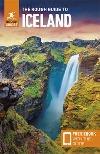
Top image: Dettifoss waterfall in Jokulsargljufur National Park, Iceland © Smit/Shutterstock
-
Plan your tailor-made trip with a local expert
-
Book securely with money-back guarantee
-
Travel stress-free with local assistance and 24/7 support
Carson (United States)
I must tell you that my tour with you is probably THE best tour I've ever taken (and I've taken a lot). My guide Rico set a bar so high that I don’t know i...
Read all reviews ⤍